Auto Ads by Adsense

Booking.com

Friday, June 30, 2006

Manchester Public Urinal

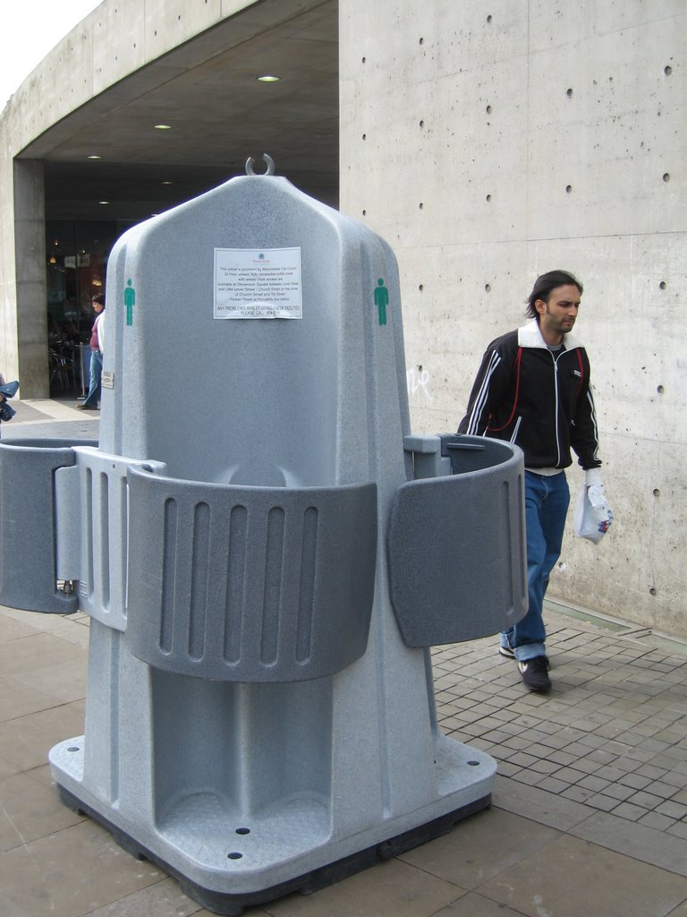
This got rolled out in front of our eyes as we were headed to the shopping area. Would you use this? What would the equivalent version for women look like? Posted by Picasa

Manchester Mounted Police

It's so unfair. Not just a bike response unit, but real mounted police too! And he wasn't a loner for tourists (Manchester not being really much of a tourist town), but had 2 or 3 compatriots! Posted by Picasa

Cycle Response Unit

Perhaps it should not be surprising that a country where 30% of trips are done by bicycle (this was in Manchester, England) would have a cycle response unit for emergency response in the pedestrain only part of town. She was wearing an NHS logo, so this was the official government unit. Her panniers has room for most first aid gear, as well as an AEB.

I'm still kicking myself for being in too much of a hurry to stop and interview her. Posted by Picasa

Monday, June 26, 2006

Packhorse versus SherpaVan

For those who have questions about Packhorse versus SherpaVan, as far as we could tell both services were equivalent in price and service. For the first 2/3rds of the walk, the SherpaVan usually beat the Packhorse in the delivery of the lugguage. The last 2 days of the walk, the Packhorse van was faster (we actually arrived before the lugguage on the last 2 days of the walk).

Packhorse advertises that you can ride the van for free with your lugguage if you can't walk the day. SherpaVan doesn't. However, our experience was that SherpaVan would happily take you along with the lugguage without a fee as well, so in practice this is not a distinguishing feature worth choosing one service or another over. Lisa can vouch for the fact that the two services enjoy a friendly rivalry and both companies work hard for your business.

We went with SherpaVan mostly because their web-site for accomodations booking is fantastic. (I've left comments with regards to various B&Bs there) Note that they have two accomodation services. You can prepay your accomodations, or you can have them book it and pay as you go. In retrospect, I should have opted for the former to hedge against the dollar taking a dive (which it did) before I arrived in England.

Patterdale Rest Day

We woke up and had a lazy, late breakfast before packing our bags and limping out down to Glenridding, which was where Ullswater was. The lake and its environments was almost certainly the inspiration for Wordsworth's most well-known poem, Daffodils. The reason we scheduled a rest day on this otherwise tiny town was that the lake had plenty to do! You could ride on the Steamers, rent a rowboat, or as we did, rent a sailing dinghy.

It had been about 5 years since I last sailed a dinghy, in South Africa, also with Lisa as the crew. But once we got on the boat and got going, it was as though I had never forgotten how. It was a windy day with lovely sunshine, and we had a lot of fun exploring the huge lake along with its little islands. The wind was even strong enough that we had to hike out and lean against the wind, along with all the thrills that that entailed. I had hoped that I would be able to rent a sailboat like this on the trip, but didn't not dare to imagine that the conditions would be so ideal.

Two hours of sailing cost us 40 pounds, a hefty sum, but on the other hand, life is measured by the experiences you have, and the experience was worth vastly more than that.

We spent the rest of the afternoon exploring the shops of Glenridding, where Lisa did a bit of souvernir shopping, and I bought a compass. (A tip, the visitor center has much cheaper compasses than the outdoor store!) The compass would be a good buy, since I ended up using it a lot for the rest of the trip.

We had an early dinner at a bar in Glenridding, and then walked leisurely back to the Greenbank Farm in the beautiful sunset.

Grasmere Rest Day

We woke up to our first rest day knowing that we had to do laundry. We walked down to town and found that a bus arrived right as we did, so we got onto the open top double-decker bus. We arrived in Ambleside after a lovely experience of enjoying the wind in our hair (though a number of tree branches had a lovely habit of hitting the windshield of the bus with a loud THWACK!) to find that the laundromat was closed on Thursdays! The tourist information center told us there was a laundromat at Windermere that was open all week.

There were plenty of outdoor shops and bookstores, however, so we bought a trail map, a can of wax for my boots, and gaitors for each of us. Interestingly enough, once we bought them, we only had one occasion where there was a need to even have them, but that's the price you pay for good weather.

The trip to Windermere did not take too long, and we found the laundromat with little trouble, but had to buy laundry tablets. We took the opportunity to have lunch, and replenish our cash supplies at the ATM. We also visited the local library to use the internet connection.

On the way back from Windermere, we stopped off at the Dove Cottage, which was where Wordsworth spent his most productive years. The visit was educational and the self-guided audio tour of the museum very much worth visiting. (Plus, they give a discount to bus riders if you save the ticket and show it to them!) We ended the day at the Jumble Room with a fine dinner to fuel the next day's journey up to Helvellyn.

Sunday, June 25, 2006

Coast to Coast nominated 2nd best walk in the World

It is indeed a very good walk. Challenging both in physical (walking) and mental (route finding, planning, and navigation) aspects. Being my first long walk, I can't compare it to others of similar stature (note that the Milford Sound walk that won first place is only a 4 day walk!). All I can say is that we chose this walk because:
  1. Lugguage service is available. It's not available on any of America's thru-hikes, for instance, or in America's National Parks.
  2. The luxury accomodations en-route makes the daily walk easier to bear. We stayed at many fabulous places and met many friendly people.
  3. It's in an English speaking country. The comraderie of the people you meet will encourage you, and give you friendly faces to see all through your journey. The fact that everyone speaks English means that you'll have meaningful, deep conversations should you desire it.
  4. It does provide a lovely cross-section of the country. At the end of the trip, our impressions were of beautiful mountains, lovely lakes, quiet forests, farmlands, fields, and lonely wind-swept moors that were truly wind-swept and lonely. It was a shock to come back to Manchester and discover that England had people, not just sheep and cows.
The downsides were:
  1. Unpredictable weather. We hit lovely weather, so we're not complaining, though I did get caught in a downpour.
  2. Trails overlaid with loose stones. It made for lots of sore feet.
  3. Expensive. It cost us about $4000 in total to do the trip (including plane tickets), making it by far the most expensive trip I've ever done.
  4. Lack of navigational aids. This is truly a trip to test your ability to navigate (or use a GPS).
All in all, I'm very glad I did the trip. It's definitely a once in a lifetime experience, and I can't wait for the 21 rolls of slide film that I sent off to come back. I'm afraid I'm now addicted to Old Peculier...

Confusing places in Stedman's book

Here are the places I got lost or confused because I was using the Stedman's 1st edition trail guide. There are two other guidebooks that I know of, Terry Marsh's and Paul Hannon's . I've seen Terry Marhs's, which has color maps interior, but didn't get a chance to evaluate it. Paul Hannon's book came highly recommended by someone who was doing the trip for the second time, so it is worth buying a copy and comparing. Overall, I found the Stedman book very well marked and quite usable, and it's the only book I have, so don't ask me about the others.
  1. Dent Hill (Map 5, pg. 76). The tree felling on Dent Hill has really messed up the directions in the first edition of the book. There's a left turn near the top, and the marked stone fences are now wire fences. The solution is to just keep going up until you see the cairn at the top!
  2. Raven Crag (Map 6, pg. 77) The clear cutting also affected this area. Make sure you read the trail map very carefully. Fortunately, this area seems to have enough recreational walkers and hikers that you can just ask a local for directions.
  3. Loft Beck (Map 12, pg. 85). This is not a confusion in the book. This is a marker to tell you to follow the book and ignore anybody else's advice! I tried to follow someone else's advice and would have been better off staying with the book right here.
  4. Kidsty Pike (Map 27, pg. 113). We lost the track past Kidsty Pike. So did Peter & Margaret. This is one of those places where a GPS would have been handy. In any case, just head down towards the reservoir and you will be OK. Ignore ALL signs to "High Street!" Have a trail map and compass handy here.
  5. Shap Abbey (Map 32, pg. 118). Head UP the hill on the Tarmac. (The book does not provide arrows pointing uphill here like it should have)
  6. Blades (Map 51d, pg. 152) We got lost here as well. My guess is that the right thing to do here would be to walk to the closest tarmac road and just follow it along. Ignore all the stupid footpath signs that will give you more ups and downs than you want and give you panic attacks.
  7. Colburn (Map 63, pg. 168) We got lost at Hagg Farm, which is unmarked. I have no idea what the correct way to negotiate this is. In any case, we ended up all the way in Walkerville. GPS would be helpful here.
  8. Urra Moor (Map 78, pg. 187) Every marker on this map I just walked past without noticing!
  9. Bloworth Crossing (Map 79, pg. 188) The path narrows and then widens again. You are at this point walking on the dismantled Rosedale Railway track, which is black! Stay on the black stuff going East past the two "gates" (which are green), and do not deviate onto the crossing dirt road. I did not get lost here but two others did. The Cleveland Way also deviates at this point and you should not follow it.
  10. Sleights Moor to Little Beck (Map 89, pg. 203) This is the only true bug (as opposed to ommission or unclear directions) in the book. After crossing A169, turn left (North) and go a few hundred yards to get to a gate (not a stile!) that turns right onto a dirt track under the electricity cables that will lead you to Little Beck. The track is well signed, just follow it.

Egton Bridge to Robin Hood's Bay

The day started at 6:00am for us, packing, eating breakfast, and preparing for Lisa's longest day of the trip. Being experienced packers by now, we were on the road by 7:30am. The flat walk to Grosmont was easy and straightforward, and we arrived by 8:15, before the trains were moving, so we were denied the same spectacle we could have seen by going to the movie screens.

As the crow flies, from Grosmont to Robin Hood's Bay is only 8 miles or so. But Wainwright (who was clearly my kind of guy) was determined to put as much additional elevation gain as possible on the last day of the trip as a farewell present to those who came after him, so the route meanders South first to pick up the steep climbs and then Little Beck Woods before double-backing and heading North East. Those who are tired of all the climbing can choose to do what the Friedmans were to do today, which is to take the flat Bridleway to Whitby and then pick up the Cleveland Way down to Robin Hood's Bay.

The road past Grosmont was signed for a 33% grade, and in fact it really was steep --- for the first time on the trip, Lisa needed both hiking sticks. Fortunately, it was foggy and cool, so we made good time, stopping only for pictures of the sign. After a good mile or so, the road flattened out near the cattle guard and we followed the sign across the parking lot onto Sleights Moor.

At the end of Sleights Moor, however, on A169, we found a bug in the Henry Stedman book: instead of turning left after crossing the road, the book indicated a right turn. After a bit of futile walking back and forth, I checked it against the Harvey Map and found the correct directions. A couple that we had met in Patterdale who were done with the trip yesterday and were driving home also stopped and confirmed my assessment of the situation.

Once we were on our way, we made reasonable time and reached LittleBeck a little after 10:15am. We were later to find out the Peter and Margaret had left about 10 minutes before we did. LittleBeck woods is a climb, but it's gentle and beautiful, so we did not mind visiting such wonders as the Hermitage, Falling Foss (which was flowing quite well despite 2 weeks of dry weather!). We emerged about an hour and a half later into the car park at the top end where we had lunch and I got my last sting from the stinging nettles.

After lunch, we followed the road to the turn-off to Sneatow Low Moor, which was very dry and an easy traverse in the now sunny day. It was here that we got our first views of the North Sea in the distance, though the digital camera failed to capture the delight we felt when we saw it. Our pace quickened and soon we were over the stile and onto B1416, a tiny road which led off into the Graystone Hills.

Here the book's directions and the trails failed us, as the Moors are criss-crossed by both human and sheep trails, all of which peter'd out after the second signpost. I did my best guess with compass and map (under pressure, as we could now see Whitby on the coast), and we soon hit a fence, but it was quite obviously the wrong fence. We decided to follow the fence North and East, following more sheep trails, and after a few adventures hopping over very boggy sections that had not dried out, found the correct stile and were back onto the coast to coast trail.

The walk through Low Hawsker and High Hawsker was a long slog, and Lisa needed a break, so we stopped at the Woodland Tearoom for a cup of tea and to finish what was left of our food from the morning. Following that, a descent past the Caravans and we finally saw the North Sea! At this point, we ran into Peter and Margaret, who were glad to take pictures of us. The walk along the cliffs were breath-taking and very much reminiscent of our first day of walking so long ago at St. Bees. We took it easy to savor every moment, but even so, arrived quickly at Robin Hood's Bay at 4:00pm.

Robin Hood's Bay is exactly the kind of village that inspired Miyazaki's view of Europe in Kiki's Delivery Service or Howl's Moving Castle. The houses are stacked and jumbled up all the way down the cliffs, and afar all you see is a chain of chimneys down to the Bay. It was a picture perfect ending to the walk.

There, we checked into our Bed and Breakfast, walked down to the Bay Hotel, and had our picture taken at the end. We were not alone, however, as we soon found our compatriots and had a great drink, signing the guest book at Wainwright's Bar, and then a filling dinner.

Blakey Ridge to Egton Bridge

As we were about to leave this morning, Peter told me that he had walked all the way back to the Rosedale junction this morning, starting at 3am. He said he couldn't sleep the night before, and resolved to complete the loop. It took him 4 hours, and it would turn today into a 30 mile day for him.

The day started with a significant bit of road walking. After not less than 5 minutes, Ray showed up and joined us. He explained that he too had gotten lost at the Rosedale junction yesterday, and followed the Cleveland Way instead of along the old dismantled Rosedale railroad track. That cost him 4 hours, and he only made it to the Lion Inn after 8. I had made a note of the departure from the Cleveway Way the day before, but even so was also confused at the junction, so there but for the fortunate happenstance of meeting other walkers would have also gotten lost.

We walked along the road atop the ridge, and slowly meandered around. Along the way, we saw the light change and grant us lovely highlights of the Lion Inn and the High Blakey House from whence we came. Once off the road, we got beautiful views of Fryupdale, a lovely valley with a strange name, a fryup being a cooked English breakfast. Peter and Margaret, having a long day today, went ahead, while Lisa, Ray and I walked slowly together.

The day was pretty flat until we got to Glaisdale, whose roads descended steeply into town. Ray left us to visit the pub, while Lisa and I pressed into the woods near Beggar's Bridge and into Egton Bridge. There, we found the Horseshoe Inn and discovered that we had beaten our lugguage into town for the first time. After checking in, we met Peter and Margaret and crossed the stepping stones in town with them.

The lady running the Inn, however, was very accomodating and did laundry for us, and left us a breakfast setting for the next day's 17 mile walk into Robin Hood's Bay. Knowing what I know now, however, I would have opted to push even further ahead into Grosmont, which has a bit more to do and save a bit of walking the next day. I was strangely untired from the previous day's efforts, so it would have been entirely feasible.

Saturday, June 24, 2006

Orton to Kirby Stephen

We started by walking over to see the stone circle by Knott Lane, which turned out to be not nearly as interesting as I'd hoped it would be. The stones were not very tall, even though they were broad, and clearly the work of men with intention to build the circle. But I estimate that three or four strong men could have done the work if they were so motivated, or perhaps less if they had horses and harnesses. Since nobody knows what the stone circle is there for, we went on and walked into Tarn Moor.

There were maps for Tarn Moor spaced at irregular intervals along the obvious trails, and with the help of my compass we made it over Sunbriggin Tarn. At this point, the weather had heated up, and we deployed our umbrellas for the first time as sunshade, something that would make us the subject of conversation for many a walker for the rest of our trip.

The long road walk wasn't very interesting, but soon enough, we came to the 3rd cattle guard, and turned off the road to walk through some farmland. Having gotten off the road, we quickly found a place to roll out our ground sheet and eat the one packed lunch we bought for both of us. The heat was unrelenting, however, so we ate as quickly as possible and moved on. After a steep descent alongside a farm, we got to Smardale Bridge and went up the steep incline afterwards, where there was supposed to be the Giant's Graves, another pre-historic monument that I missed. A few farms, a road, and then a railroad tunnel which in normal English weather would have been completely muddy but was indeed quite dry, and we were in Kirby Stephen.

A question about the Redmayne House at the first people we met yielded excellent directions. We arrived at the house, which looked rather ramshackle on the outside, but when we were brought in were delighted to find bright airy rooms with enormous bathrooms and lovely furnishings.

Laundry, grocery shopping, cash extraction from the nearest ATM later, we were found an excellent Fish and Chips place that served incredibly fresh fish. Satisfied, we went back to the Redmayne House and had a footbath before going to bed.

Tales of the Slayers

A comic book written mostly by the creator (Joss Whedon) and various writers (Jane Espenson, Doug Petrie, and David Fury) and even an actress (Amber Benson) from the TV show, about various different slayers across history and the lives they chose to lead or were forced to lead.

One of the interesting highlights is Whedon's story, not because it is anything special, but because it also highlights the fact that Whedon is probably not a Christian. If you look at the entire Buffy series in retrospect, you'll see that the show deliberately shys away from any discussion of the theological, even though you might consider that this would be the most important facet of being a slayer. (After all, why do crosses and holy water work against vampires?) Instead, Whedon chose to focus on the arcane books and research as presented by Giles the librarian (played by Anthony Stewart Head), who comes across as non-Christian as anybody could be.

In any case, it must have provided a major dilemna for Whedon, and it's a testament to his talent that I watched the entire show without realizing the central problem he tiptoed around. (Note that he happily gave the name "Faith" to a slayer who went awry) In any case, Whedon's story in this book depicts a Slayer who believed in God, who was then abandoned by God at her time of need. It's an entertaining read, and given that I paid 3 pound sterling for the book, worth the money.

Pictures from today's Ride

Despite the heat, Matt & I managed 53 miles and 1370m (4500ft) of climb, up Moody, Page Mill, down West Alpine, and back up over Old La Honda road and 84. Check out the pictures (click on the title) --- fog in the valley in Silicon Valley made for a dreamy morning.

Shap to Orton

This was meant to be a recovery day after the massively difficult previous day. In the morning, Margaret asked us if we would like her to do our laundry. We were happy to do so, and left her our laundry before leaving. A footpath right behind her house led us past a farm and then a public footpath to the overhead pedestrain bridge over M6. Once there, we followed along some paths and then walked across a quarry road to skirt the walled village of Oddendale.

There was supposedly a stone circle in the area, but it wasn't obvious how to find it, and we passed it by while wandering through the Moor. The day was overcast, and we moved along slowly, since we were still weary from the day before, and the terrain was not exactly flat --- the Moors roll up and down, and while the going was not exactly strenous, it wasn't smooth, either.

After a few false sightings, we found Robin Hood's Grave, a cairn that didn't seem to be anybody's grave, let alone Robin Hood's. We were later informed that there are about 8 of his graves scattered all over England, so it was a good thing that all we did was to take pictures and moved on.

The highlight of the day's walk was the stroll from Brodfell farm into the village of Orton (it looked like a pretty big village to me, but the denizens insisted that it was one). We passed through delightful fields, across multiple gates and was accompannied by a babbling brook. Once in Orton, we discovered that we had arrived before the Kennedy's chocolate factory had closed. We had tea and chocolate cake there, and bought a couple of day's worth of chocolate for the next days' walks.

We arrived while the Mostyn House B&B owner was out, but we didn't have to wait too long before she returned, and we had a good shower and helped check in the other guests, Eric & Katie Bryant from Colorado, and Andy & Bey Friedman from Canada.

Margaret delivered the laundry to the house while we were showering, and we had a good and restful rest of the evening and night.

Grasmere to Patterdale

We started off after breakfast to walk the highest point (for us) on the coast to coast, Helvellyn and Striding Edge. The walk up to Grisdale Tarn happened while it was still cool, and we ran into a British couple on the way there, who gave us an explanation of what the various terms were:
  • fell: between a mountain and a hill
  • tarn: mountain lake
  • beck: mountain stream
We arrived at a waterfall, where Lisa & I took pictures, and then split up, with Lisa & I going ahead, since we had Helvelyn to get to. The walk up to Grisdale Tarn was easy and not at all strenous, and once there, I looked for the brother's parting stone, to no avail.

We walked up Dollywagon trail, passing workers who were there to spread stones on the trail to prevent more erosion. Near the top, however, we walked past the start of Striding Edge without noticing. Fortunately, we stopped to eat, and were soon corrected.

For the last couple of days, we'd been warn that Striding Edge was a difficult and scary traverse along the ridge. The descent certainly required a fair amount of scrambling, but once on Striding Edge proper, Lisa simply walked along the ridge easily. It didn't seem that hard at all. We were later to learn, however, that a person had fallen off Striding Edge and sustained severe injuries.

From Striding Edge, we walked to the hole in the wall and descended steeply along Birkhouse Moor and then to a tarmac road where directions once again confused us, but we fortunately were able to ask someone and made it down to the bottom of the valley with no problems. There, I called the Greenbank Farm which gave us directions, which we followed. The Farm was quite a distance from where the trail bottomed out, so we hobbled along, once again footsore from our exertions, but the knowledge of a rest day ahead helped us.

We arrived at the Greenbank Farm, where Peter and a dozen dogs greeted us. Peter told us that he actually owned all the Farmland all the way up to Helvellyn and we had walked past his sheep on the way down. After a shower, he was gracious enough to give us a ride down to the restaurant in Glenriding, where his daughter worked. She gave us a ride home after a much needed meal and we slept well that evening.

John Bogle interview podcast

What an inspiring man! He brags about making much less than the chairman/CEO of Fidelity. He talks matter-of-factly about how he started the first index fund (and the Vanguard group, which is an astonishingly high performance company), and where the industry is going. I very much hope that his company continues to keep the faith and fight the good fight. I'm going to read his book as soon as possible.

Friday, June 23, 2006

Tips for the Trip

Dos:
  • split the long 20 mile days into shorter days. The walks are tougher than you think, not because of the elevation gain or even the steepness, but because the trails have been deliberately strewn with rocks and stones to prevent trail erosion, which throws off your balance and makes you footsore.
  • Take rest days, especially if you’re planning any of the high options. We wouldn’t have been as willing to do the high options if we hadn’t had rest days scheduled after them. Richmond has enough to do that an additional rest day there would be welcome, but be aware: Richmond has no laundry facilities! In particular, if this is your first long distance walk, schedule a rest day early in Grasmere or Kirby Stephen so you have the chance to buy additional equipment should you need it!
  • Bring GPS, compass, and a trail map (and know how to use them --- it does take special effort to input waypoints for the GPS if you’re going to use it to navigate, so leave plenty of time before the trip to do this). The Ordance Survey #33 + #34s are supposed to be the best, but are now out of print, so an internet search might be necessary.
  • Bring gaiters in case it gets muddy.
  • Raingear is a must. Umbrellas are particularly useful since if you encounter a spell of hot weather (like we did), they serve as sunshade, and you’ll be the envy of other walkers.
  • Train for the trip.
  • Have an extra pair of socks in your backpack.
  • Have a cell phone handy. (Note that Keld actually has a payphone and cell phones don’t work there, so you’re probably likely to want to have some pocket change as well)
Don’ts:
  • do the entire trip in one go by the book unless you’ve got experience with other long distance walks and are confident that it’s what you want to do. We met others who wished they’d scheduled rest days, or extra days in particularly interesting areas.
  • Buy bag lunches. We tried them, and it’s way too much food. One bag lunch for two people would be sufficient. You definitely don’t get as hungry or as desirous of food hiking as you do cycling.
  • Expect signposts and mile markers. Especially in the National Parks, as they don’t exist.
  • Schedule B&Bs off the trail unless you’ve got a very good reason for them.

On British National Parks

Unlike U.S. National Parks, the British National Parks are not government or public property --- they are a collection of land under private ownership that has been designated as National Parks, so are under certain building restrictions. Hence, most of the land you’re walking through is public property where walkers have been granted rights of way either by common law or by agreement.

To keep the rural feel, British National Parks do not have proper signposts or destination markers on their footpaths. (This is a silly policy, if you ask me, but it’s their National Park) I didn’t think a GPS was necessary before I left, and I did manage with just a map and compass, but I now think that was foolhardy. If the weather had been worse, we could have easily gotten really lost. You still need to be a good navigator with map and compass (and I’m a reasonable one, despite being years out of practice), but if the fog comes down you’re not going to be able to orient yourself with landmarks.

Interesting B&B notes (Coast to Coast)

  • For an early start from Osthmotherly: stay at the Mill House
The Following Places were willing to do laundry:
  • Brookfield Guest House (Shap)
  • Old Brewery (Richmond)
  • Mill House (Ostmotherly)
  • Horse-shoe Inn (Egton Bridge)
The following villages have laundry facilities:
  • Kirkby Stephen
  • Windemere (from Grasmere)
  • Ambleside (from Grasmere, closed on Thursdays)
Places that have WiFi
  • Ennerdale View B&B (Actually a 1.5 mile walk in Kirkland)
  • Tan Hill Inn
  • Mill House (ask for a WEP key)
  • Old Brewery
  • Old School (Danby Wiske)
  • Britannia Hotel (Manchester)

Sunday, June 18, 2006

Quicken for Macintosh is an Unacceptable Product

I'm a veteran Quicken user, so you'd think that I'd take to the Mac version of Quicken like a duck to water. The reality is, however, that it's an unacceptable product. First of all, it refuses to accept imports from the Windows version of Quicken, making migration darn near impossible. Secondly, when starting from scratch, it downloads past transactions from my banks but refuses to look at the current balance, so it ends up with ridiculous negative balances because it doesn't realize that the account did start with money years ago when it was first created.

The summary: Quicken for Mac is serviceable if you're a fresh graduate with no transaction history worth caring about or if you're willing to give up that transaction history and set everything up manually with no history. For veterans of other products, it is terrible, and is basically another reason for me to boot into Windows XP on my Mac.

Now where's Microsoft with a competitive product when we need them?