Auto Ads by Adsense

Booking.com

Monday, October 04, 2010

Day 13: Banff to Many Glacier

I woke up in the morning and made breakfast in the kitchen. I heard two women talking about driving to Glacier National Park en route to Minnesota. I asked if they knew that Logan Pass was closed. "No!" "Well, yes it is. On the East side you can drive all the way to Logan Pass but you won't be allowed to go over. On the West side you get to Avalanche Creek and then it's game over." "Well, that settles it. We're going to go to the East side then." They were on a road trip from their summer jobs in Alaska, and highly recommended that I visit Alaska one of these days, preferably during the summer. I knew what I wanted to do next summer, but maybe the summer after that I'll visit Alaska.

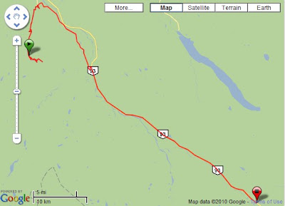
It was drizzling as I pulled out of the parking lot for my morning shoot. I wanted to see if Two Jacks would be better and that maybe I would see a rainbow, but no luck at all this morning. With a sigh, I pulled out and started driving towards Kananaski Provincial Park. In the cloudy morning like Kananaski Provincial Park was gorgeous. With clouds blowing in and out of the road I felt like in the dream world.
From 2010 Canadian Rockies Journalism
From 2010 Canadian Rockies Fall Colors

The kicker, though was the amount of wildlife seen on the road! Because the road was so isolated and deserted, wildlife was frequently seen on the road. In fact, the first time I saw a pair of Moose on the road side I thought they must have been plastic reproductions, since they were so big and did not move even though I was approaching. When I saw they were real I stopped and put on the 200mm lens. The lesson I've been learning on the entire trip is that when I'm driving I just need to run the longest lens I've got in case I spot wildlife.
From 2010 Canadian Rockies Fall Colors

He was quite an animal, and I was very impressed. Less than a mile later I ran across a group of goats who were happy to have me shoot them while they went all over the road. These animals were not at all afraid of humans and cars, and I could even drive up next to them if I wanted to. It was an amazing sight.
From 2010 Canadian Rockies Fall Colors

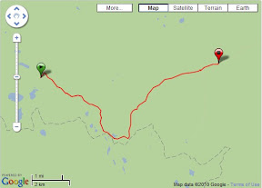
Driving out of the park, the GPS unit navigated me onto a dirt road. I thought about turning back but I've never denied myself the chance to ride an obscure dirt road on a bicycle, so why stop just because I had a mini-van? One of my favorite song quotes was from the Cowboy Junkie's Anniversary Song:
Have you ever satisfied a gut feeling
to follow a dry dirt road that's beckoning you
to the heart of a shimmering summer's day?
So I indulged myself and followed the road. At first it drove through foreboding country: obviously the land here had been logged and/or burned, with big patches of empty hill side and long stretches of blackened tree stumps. But in a little bit I was rewarded by the sight of a cowboy, his partner, and two dogs at work herding some cattle into a field. I shot pictures from the car and tried not to disturb their work or the cattle.
From 2010 Canadian Rockies Fall Colors

It was with no little relief, however, when I drove back onto pavement near Waterton Lakes National Park, and saw the fall colors still present in neat little clumbs near farmland.
From 2010 Canadian Rockies Journalism

I had intended to detour into Waterton Lakes for a quick look on the way to the US border, but a signboard informed me that the Chief Mountain customs office was closed for the season. I reprogrammed the GPS to point me towards Cardston, which was the other customs location nearby. On the way there I saw a farm that looked pretty to my eyes and pulled in for a quickie shoot.
From 2010 Canadian Rockies Fall Colors

I stopped by Cardston's tourist information center to ask about the weather and use the rest room. The lady there was familiar with the Cobblestone Manor and told me it had changed management recently. That made me feel a bit better about missing them twice. They were still closed today because it was a Monday. Maybe some day when I return for a summer backpacking trip I can still visit.
From 2010 Canadian Rockies Journalism

The drive across the border happened in the rain, but that meant there was so little traffic that the U.S. customs official felt obliged to justify his pay by looking into my van to make sure I didn't have any undeclared merchandise. I drove into Babb and gassed up my car (cheap American gasoline!), and then drove into Many Glacier to find a picnic table to make an early dinner so I could shoot the sunset. I met another camper and we agreed to share a campground. That turned out to be only $5 each, which was a good deal since I did not want to use that gravel parking lot in St. Mary's after the bad memories.

Driving out of Many Glacier, I spotted in my rear view mirror a gorgeous sight --- Lake Sherburn had clouds that looked beautiful, and lent the place a ghostly light.
From 2010 Canadian Rockies Fall Colors

I shot several shots and worked the angles a bit and then moved on, hoping against hope that I was not too late. It turned out that over the past two weeks the sunset time had shifted until I was pretty much too late. The cloud cover had also caused the sunset to be early, and as I drove back and forth the Chief Mountain International Highway I cursed myself for not being attentive enough to the weather conditions and missing what was a great shoot. I salvaged the situation in time by returning to an old familiar spot and getting two final glorious shots of the Montana Sky in action.
From 2010 Canadian Rockies Fall Colors

I did not know it then, but it was to be my last good shoot of the trip.

Previous
Next

Sunday, October 03, 2010

Day 12: Wilcox Pass Trailhead campground to Banff

I woke up bright and early and ready to hit the trail. Well, actually, I dithered a bit because I was in no hurry to get up to the ridge and then spend my time walking back and forth trying to stay warm. Nevertheless, it was 6:10 when I hit the trail, which was plenty of time to get to where I wanted to go.

Right on schedule, I hit what I considered to be a good spot at 6:50am. What's interesting was that I had made no notice of where I wanted to be the day before. I was simply making a consistent decision vis-a-vis photography from day to day, which was a good thing. I had forgotten my android phone, so I could not make ultra-long exposures consistently, but I immediately set up my tripod and got something that looked pretty good to me.
From 2010 Canadian Rockies Fall Colors

Note that it was dark enough and 30s was long enough that the stars were beginning to produce star-trails in the photograph. I shot several exposures, and started bringing out the 200mm to capture what looked like a beautiful sunrise from behind the mountains. Yes, the very mountains that were frustrating my photography.
From 2010 Canadian Rockies Journalism

Moments later, the sun finally started hitting the clouds and the snowscapes, and I started getting interesting alpenglow colors.
From 2010 Canadian Rockies Fall Colors
From 2010 Canadian Rockies Journalism

The light was changing rapidly and I worked at a furious pace, knowing that I had at most 20 minutes to capture this amazing light. I was right. By 8:20am the lightshow as over and the only thing I had left to do was to shoot a picture of myself in front of the mountains in the morning light.

From 2010 Canadian Rockies Journalism

I got back to the car where I met another hiker who told me that she'd been staying near the Cline River, off the Sasketchewan crossing. I made a note to look it up, knowing that I would be unlikely to find time to do it on this trip. I had 2 days left, and it was time to start driving South.

I headed South once again along the Icefield Parkway. Petra had mentioned that the Path of the Six Glaciers was worth checking out, and had said that it was only a 4 hour walk. I could definitely manage a 4 hour walk on top of Wilcox pass. Then after that I could head down to Banff in search of more sunset beauty. The drive was uneventful. I stopped at the Sasketchewan crossing for breakfast and to charge some batteries, and then later on I stopped several times for pictures but in the later morning light it really was futile. I ended up with pictures with muddy washed out colors that wouldn't be interesting at all to anyone else.

I arrived at the Banff Visitor Information center, confirmed everything Petra had said, and proceeded to drive up to Lake Louise to start the hike. What a contrast Lake Louise was to earlier visits in the morning. The place was packed with tourists and visitors walking along the lake shore. Boats were on the water, and it looked like everyone was out. It was an overcast day, and I set a furious pace along the flat section so I could get away from the mass of tourists.
From 2010 Canadian Rockies Fall Colors

At the end of the lake, the stream feeding the lake became a delta, and the path started climbing up towards the Swiss-style tea house at the end of the trail. I learned from signboards posted on the walk that Swiss mountain guides had built the trail and the teahouse in the 1920s, which explained why everything was so well engineered and pretty. As the trail steepened I spied another hiker in front of me. She was going about the same pace I was, except that once in a while she would stop. At one of her stops she turned around and spied me, and waited for me to catch up before we started walking together. That was how I met Janice Belliveau.
From 2010 Canadian Rockies Journalism

Janice and I were kindred spirits, for we immediately hit it off and had great conversation that went the length of the hike. She was from Nova Scotia, from Belliveau Cove, one of the great wooden ship building centers of the 19th and 20th century. Her father was restoring a great wooden ship for fun, even though he was not a sailor. She was here for a conference that would start tomorrow, and decided to do the hike alone because she had started hiking only a year ago. She was clearly a highly self-motivated person because she was clearly pushing the pace even though I was content to go at whatever speed she chose.
From 2010 Canadian Rockies Journalism

At the tea house, we stopped for some tea and chocolate cake. Intrigued by the menu item which listed ice wine tea, I ordered some and it turned out to be exquisite. I resolved to order some as soon as I got home. Our table was next to another couple from San Francisco. Janice and I were both the kind of person who made friends easily, and soon enough all 4 of us were talking. It turned out that 3 out of the 4 of us were the same age. We enjoyed chatting with each other and exchanged information. I was delighted to see the kind of thing that Richard Wiseman talked about in The Luck Factor used and applied directly by Janice. She would attend conferences with the goal of meeting specific people and engaging them. This was someone who took charge of her destiny and was able to seize opportunities as they came up.

Speaking of opportunities, we saw that there was a way to turn the walk into a loop instead of an out and back hike, so we took it. The return loop took us high up above the lake, where we got to see the hotel at the edge of the lake as well as the turquoise that was characteristic of a glacier fed lake. All the way down from the mountain, Janice would tell people how far they were from the summit or the tea house, all without skipping a beat in our conversation, which revolved around her business, her kids, photography, hiking, and how we chose to spend our time. At the pace she set, we were done with the hike in 4 hours, and said goodbye to each other at Lake Louise.

I drove down to the visitor center to use the washroom, and there met two cyclists who were planning to ride to Argentina (they had already finished with the Ice Field Parkway that day, and I saw them riding earlier in the day while driving down the parkway).
From 2010 Canadian Rockies Journalism

Justin and Nathan had not started riding together, but they were riding together for this segment. They spoke of carrying enough food to last for days, lots of great weather and good cycling. The trip was clearly to their taste and they were enjoying themselves, even though once on the coast they would likely face headwinds if the La Nina year brought early storms to the Pacific North West. We exchanged stories about touring and then I headed South for Banff.

At Banff, I stopped by the Safeway to restock for the last 2 days worth of food, more chocolate, and then went to the youth hostel to use my newly acquired hosteling international membership. At $29.70 a night it was a pretty good deal for me to get my batteries charged, a warm shower, and some indoor cooking. The weather was extremely cloudy, which led me to be pessimistic about the chances of a good photo. I moved into my room quickly and then made dinner, chatting with other random strangers in the kitchen, including a biologist who quit his job to work as a hostel manager part of the year. He managed 3 wilderness hostels, and enjoyed having the free time to relax between the rest of the year.

After dinner, I drove to Mt. Norquay in the hopes of getting a sunset, but the gray clouds were persistent. Hoping to make the best of a bad situation, I decided to aim for dusk shot of Banff.
From 2010 Canadian Rockies Fall Colors

After the shot I returned to the hostel to find that my bed had been moved. I needed a lower bunk because otherwise the power cord would not reach my CPAP machine. I moved back to the bunk and moved my stuff in. My other roommate, a woman from Sydney, told me that she'd never seen anything so rude! Well, I needed a shower so I ran off and took a shower. Unlike the shower in Jasper, the shower here was slow and only a little bit warm. I took a shower, brushed my teeth, and then headed back to my room to find my other roommates there. It turned out that it was two women traveling with Moose Travel Network, a popular travel agency made famous by Lonely Planet. Since I didn't read Lonely Planet, I didn't know about them. Stella and Naoko (they were not traveling together, but had some itinerary in common) apologized for not understanding the etiquette of moving people around in shared accommodations, and with that the dark cloud over my hostel stay was over.

Stella was from Canton, and Naoko was from Japan but was studying in Canada. It was amusing because I speak Japanese quite a lot better than I speak Cantonese, so Naoko and I could converse a little bit while Stella and I would speak in our respective Chinese dialects. "How many other languages do you speak," asked Stella. "German and French too?" said Naoko. I said, "Just enough to get by." "I was only joking!" "Awesome!" Stella was quite a traveler, and told me a few stories of her travels in China (still a country I have yet to visit). The stories told of someone with plenty of self-confidence and resourcefulness. I usually disliked these bus tours as being dragged around by the nose, but it was clear that Stella found a way to make them work for her, as well as working around the limitations in ways I did not imagine. I showed Naoko photos from last year's Tour of Hokkaido. She loved the look of Yubari Youth Hostel and said she would try to visit there.

The forecast did not bode well for the next day, but as always, I had to try. The tourist information office told me to drive through Kananaski Provincial Park on the way back to Glacier National Park (I was hoping for one more full sunset and sunrise there), but if you don't get up at 6:00am, you don't get to see rainbows and other nice things. So I committed to getting up again at that hour.

Previous
Next

Saturday, October 02, 2010

Day 11: Jasper to Wilcox Pass Trailhead Campground

The morning found me downing a quick breakfast of ramen, tea, and sneaking out of the youth hostel by 6:30am. I started worrying about getting to the Mt. Christy lookout by first light, but I needn't have worried. The mountains kept Mt. Christy and others in shadow, which meant that I had plenty of time with which to shoot the sky prior to the anticipated alpenglow.
From 2010 Canadian Rockies Journalism

When the actual alpenglow arrived, it was quick. I estimate the time of the start of the colors and the time of the finish was no more than 15 minutes. This was to be anticipated: it took till 8:00am before the light started to show, which meant that our golden hour was cut short by at least 20 minutes. I worked furiously at the Mount Christy lookout, and then drove quickly to the next site North to work it as well.
From 2010 Canadian Rockies Fall Colors

Afterwards, I found out that other photographers were congregated at another site just a little further north, at a designated lookout point. If I had more time I would have tried that as well. I then headed towards Mt. Edith Cavell, which turned out to be on the road leading to the Athabasca Falls. I vaguely remember this set of Falls from 15 years ago, and paused for several pictures and some video.

From 2010 Canadian Rockies Journalism
From 2010 Canadian Rockies Fall Colors

I then stopped by a road-side picnic area to make a bigger breakfast (brunch, if you choose to call it that), eating some bread, eggs, and then my eyes fell upon some expired freeze-dried food I had packed just to see whether expired freeze-dried food was edible. The food had been acquired from ages ago when Lisa was still eating seafood, and I didn't find it particularly palatable then, and it was even worse now. I quickly threw away the rest of the expired food after an initial tasting. I supposed that if I was stuck away from other food sources for 3 days I would find it palatable, but I figured that I would save my future self from such misery by tossing it away now while I still had my head screwed on straight.
From 2010 Canadian Rockies Journalism

Mt. Edith Cavell's glacier walk started in a Canyon that's pretty much obscured from the sun during most of the day. Definitely some place to visit for a sunrise shoot one of these days, since even by mid-morning when I had started, the place was already nearly covered by shadows from the surrounding mountains. I walked up the trail rapidly, catching up to a group of Michigan hikers whom I enjoyed a conversation with, so chose to walk with them for a while. They mentioned that they were in the rockies for a week, hiking twice a day, but Michigan did not have any hills, so they struggled a bit on the climbs. This gave me plenty of time to do photography though!
From 2010 Canadian Rockies Journalism

Kenneth was a cyclist, so I pointed him at my cycle touring web-site, and told him about the 2007 tour, since he was headed to that area of Switzerland next year. Since Ken was a CPA as well as a cyclist, we enjoyed a conversation about the kind of people who needed financial advice, the kind of people who ignored advice, and what the consequences turned out to be. Some of his stories were truly mortifying, but having similar stories of my own, I was not too surprised. The hardest part about investing is emotional control, and it's one factor that has no relation whatsoever to how smart you are. It's not a surprise at all that even the smartest people I've met have trouble overcoming their own greed and short-sightedness.
From 2010 Canadian Rockies Journalism

We got to the part of the trail where the easy walk ended and the strenuous uphill climb and scramble would start. We said goodbye to each other and I began the climb in earnest. The trail was barely defined and steep. More than once I wish I had had the foresight to bring my hiking poles. To my surprise about 45 minutes into this section I ran into two familiar faces. I recognized them from the hostel last night: they were two German speaking girls. Apparently the hostel manager had given them the same advice he'd given me (probably sans the sunrise location). "It's much longer than it looks," one warned me. (Never mistake a clear view for a short distance is one of my favorite quotes from Beyond Entrepreneurship, a book Reed Hastings talked me into reading years and years ago) The other said, "It gets quite slippery at the top with a lot of loose rock." Well, I had water, I had food, and I was used to pain, so I pressed on after asking the two girls for a photo of myself.

They were not kidding about the steepness and the climb, and in fact, at the start of the scramble I was forced to drop my backpack full of photo gear and my tripod in favor of going light with one lens, the SLR, and of course, my backup camera. I figured my photo gear was safe because if anyone actually tried to steal it while I was scrambling, by the time I came down I'd have a very easy time catching him on the downhill and without a load. The top of the scramble was spectacular, not only lending a great view of Mt. Edith Cavell, but on the other side, an amazing view of the ice field parkway. The wind was very strong and there was no one else around, causing me to have to pile rocks together to make a tripod with which to get pictures.

From 2010 Canadian Rockies Journalism

You should ignore the GPS coordinates for most of those pictures, since the GPS unit was abandoned along with the rest of the camera bag. The descent was a little sketchy, causing me to fall at one point, but fortunately it was a "sit down suddenly" type of fall, so there were no bruises except to my self-confidence. My camera bag was still waiting for me when I arrived, so I strapped it on and started hiking down, which was a much faster descent than the climb up. I started meeting lots of people, and then realized that I was encountering day visits, including the outdoors club from Prince George University. I had a brief conversation with them and then headed on my way to finish the rest of the easy walk.
From 2010 Canadian Rockies Journalism

Mt. Edith Cavell's glacier was pretty, with lots of waterfalls flowing off it overhanging a cave. The park ranger told me not to go there, even though there were lots of tourists standing under the glacier getting photos. "The glacier can calve multiple times a day, sometimes with no warning. If you're standing right under it when it does..." She did not have to finish the sentence.

It was mid-afternoon by the time I got off the trail, but I wanted to check out the Columbia Icefield the next day. I was told to stop by the Beauty Creek Youth Hostel to speak to the manager there, whose name was Tim. I arrived around 4:00pm, and he took the time to tell me about possible places to go, one of which I was probably going to use, Wilcox Pass. He mentioned a bush-whack that could get me a better view, but I was dubious about making the trek in the dark. "You do have time to scout it out now, you know." That was a good point. So I hurriedly ate dinner using the hostel's stove, and then drove out, passing what looked like a good Falls for sunset on the way to the start of Wilcox Pass.

I was pretty tired from one already strenuous hike that day, but that meant that my pace would be similar to what I could manage in the dark. I started the hike in shadow but after about 40 minutes made it to the ridge of the pass. From the ridge I could tell that it would be a long walk to get to the mountain in front of the ice field, but furthermore, from a photographic point of view, it would not be necessary. The big glaciers were right in front of the Wilcox Pass trail, and with a telephoto I could reach all the areas that would be hit by Alpenglow. Even the ridge line in front of me could be useful, and not necessarily be a hindrance.

With that bit of responsibility done, I hiked back down to see what I could make of the fading light. As I drove past the ice-field, the remaining bit of evening light caught my eye and I drove to the ice field's parking lot and made several exposures with the mountains and snow against the changing light.
From 2010 Canadian Rockies Fall Colors

The limited extent of the light meant that I had to use the 200mm lens, which is a continual source of wonder to me. Fully open it is beautiful and sharp, but stopped down and aimed at a mountain top it has a magical quality that impressed me.

I kept driving into the twilight to verify that Wilcox pass was the best place to be. In photography, the amount of effort put into the photo has nothing to do with the results, and sometimes the road is a better place to shoot. I thought I had found a better place until I checked the compass and realized that it would be entirely back-lit by sunrise. So Wilcox pass it was. I decided against staying at Beauty Creek hostel: it had no power or showers, so I might as well camp out at the Wilcox Pass trailhead, which conveniently had a shower. On my way back there, however, I saw a pair of mountain goats, and snapped several shots with my 200mm wide open. The camera was set at ISO 3200, which meant that I would be lucky to get anything at all, but to my surprise my Canon once again came through with a shot that I would never have expected from my days of shooting chemical film.
From 2010 Canadian Rockies Fall Colors

I arrived at the campground around 8:00pm, brushed my teeth, set up my sleeping bag for sleeping in the van, and set my alarm clock at 6:00am again. Not having to drive far the next morning allowed me to sleep in.

Previous
Next

Friday, October 01, 2010

Day 10: Egypt Lake Hut to Jasper

I slept in, waking up only around 8:00am, which told me that I had been building up sleep debt. It was still cold inside the hut, however, so I put on my down jacket and proceeded to make breakfast as quietly as I could, since my companions were still sleeping. At the same time, I started packing up my stuff, since my stove was slow. I pretty much burned all my fuel, and burned a lot of my garbage in the fireplace last night, so this was the lightest pack out weight I've ever had.

It took me until 9:30am to leave, but there was still frost on the ground as I said goodbye to the hut and walked across the bridge I had come by 2 days ago.
From 2010 Canadian Rockies Journalism

The first part of the walk out was familiar territory by now, having done so twice before. Healy pass was beautiful in the morning, even though the light was drab by the time I got to the top around 11:00am.
From 2010 Canadian Rockies Journalism

Once at the Simpson pass intersection, I opted for the route along Healy Creek, which drove me down into the pine forests, losing all my views for the rest of the hike. The hike at this point was fairly gentle, though with several steep pitches. It was also very confusing, because occasionally the signs would be pointed to some other parking area, not the Sunshine Ski Resort.
From 2010 Canadian Rockies Fall Colors

I started meeting more hikers, but you can always tell when you get to a crowded area because people stop saying hello and just keep going on whatever conversation they had before they saw you. The last kilometer, I took a wrong turn and ended up on the dirt road the shuttle had used, rather than on the trail. This turned out to be a good thing, as I saw a herd of goats along the road, which I wouldn't have seen along the trail. I got out my camera, but they were standing in shadow and I couldn't get a good shot. I hiked back to the car, but a truck had come down the road and driven off the goats. There was nothing for me to do but unpack, switch shoes, eat lunch, and dump my garbage into the bear-safe containers.
From 2010 Canadian Rockies Fall Colors

It was my lucky day for wildlife, however, since when I started my drive down, I saw the herd of goats right in front of me. I stopped the car, got out my 200mm, and started shooting. I saw a second herd on the way down and shot that too, and then decided that I really should drive to Jasper.

The drive up the Ice Field Parkway was nice, but one thing I realized was that the highway mostly followed the river valleys and the plains, which meant that there weren't very few vantage points from which to shoot. Worse, the lodging was far from many vantage points. One exception was the area around the Columbia Icefield, with plentiful parking, turnouts, and campgrounds. I made a note of that. I also noted that sunsets were very tricky: the high mountains to the East practically put the entire valley into shadow well before the 7:30pm sunset time, which would make sunset shoots very very difficult.
From 2010 Canadian Rockies Journalism

I arrived at Jasper at 5:00pm. Hien worked there, and had offered me a shower if I showed up, but when I called her while filling up my car, there was no answer. I really wanted a shower, so I headed over to the Whistlers youth hostel right outside Jasper, picking up a hitch-hiker while going there. It turned out that I was lucky to arrive at the hostel when I did: they were running a special where you got one night free stay if you signed for the membership. The cost of the membership was $25.70, $0.50 more than the cost of a night's stay. Well, my mom didn't raise no dummies, so I quickly signed up to be a member and got my night's stay. I quickly made dinner, and then ran out hoping to get sunset shots. Maligne Canyon was supposed to be good, but on the way there I got distracted by Elk walking around right along the road outside Jasper.
From 2010 Canadian Rockies Fall Colors

These photos were shot at relatively high ISO, and I was impressed once again by the Canon 5D2. In my film days, I would never dream of being able to shoot at ISO 500 to get decent photographs (and swapping out film canisters was a pain anyway). I got to the Maligne Canyon look out after most of the interesting light was gone. I did get a few interesting cloud and sky pictures, but nothing to write home about.

Returning to the youth hostel, I finally got my shower, did laundry (special thanks to the hostel manager as I had run out of Canadian money and he had to make an exception so I could use the dryer), and spent the evening chatting with a retired Japanese man trying to learn English. The hostel had WiFi, which I used to catch up on e-mail. I also spent significant time talking to the hostel manager about where to go for sunrise. He suggested the Mt. Christy lookout, and the Mt. Edith Cavell scramble/hike after that. That sounded intriguing so I made a note of it and set my alarm at 6:00am again.

Previous
Next