Saturday, June 24, 2006
John Bogle interview podcast
What an inspiring man! He brags about making much less than the chairman/CEO of Fidelity. He talks matter-of-factly about how he started the first index fund (and the Vanguard group, which is an astonishingly high performance company), and where the industry is going. I very much hope that his company continues to keep the faith and fight the good fight. I'm going to read his book as soon as possible.
Friday, June 23, 2006
Tips for the Trip
Dos:
- split the long 20 mile days into shorter days. The walks are tougher than you think, not because of the elevation gain or even the steepness, but because the trails have been deliberately strewn with rocks and stones to prevent trail erosion, which throws off your balance and makes you footsore.
- Take rest days, especially if you’re planning any of the high options. We wouldn’t have been as willing to do the high options if we hadn’t had rest days scheduled after them. Richmond has enough to do that an additional rest day there would be welcome, but be aware: Richmond has no laundry facilities! In particular, if this is your first long distance walk, schedule a rest day early in Grasmere or Kirby Stephen so you have the chance to buy additional equipment should you need it!
- Bring GPS, compass, and a trail map (and know how to use them --- it does take special effort to input waypoints for the GPS if you’re going to use it to navigate, so leave plenty of time before the trip to do this). The Ordance Survey #33 + #34s are supposed to be the best, but are now out of print, so an internet search might be necessary.
- Bring gaiters in case it gets muddy.
- Raingear is a must. Umbrellas are particularly useful since if you encounter a spell of hot weather (like we did), they serve as sunshade, and you’ll be the envy of other walkers.
- Train for the trip.
- Have an extra pair of socks in your backpack.
- Have a cell phone handy. (Note that Keld actually has a payphone and cell phones don’t work there, so you’re probably likely to want to have some pocket change as well)
- do the entire trip in one go by the book unless you’ve got experience with other long distance walks and are confident that it’s what you want to do. We met others who wished they’d scheduled rest days, or extra days in particularly interesting areas.
- Buy bag lunches. We tried them, and it’s way too much food. One bag lunch for two people would be sufficient. You definitely don’t get as hungry or as desirous of food hiking as you do cycling.
- Expect signposts and mile markers. Especially in the National Parks, as they don’t exist.
- Schedule B&Bs off the trail unless you’ve got a very good reason for them.
On British National Parks
Unlike U.S. National Parks, the British National Parks are not government or public property --- they are a collection of land under private ownership that has been designated as National Parks, so are under certain building restrictions. Hence, most of the land you’re walking through is public property where walkers have been granted rights of way either by common law or by agreement.
To keep the rural feel, British National Parks do not have proper signposts or destination markers on their footpaths. (This is a silly policy, if you ask me, but it’s their National Park) I didn’t think a GPS was necessary before I left, and I did manage with just a map and compass, but I now think that was foolhardy. If the weather had been worse, we could have easily gotten really lost. You still need to be a good navigator with map and compass (and I’m a reasonable one, despite being years out of practice), but if the fog comes down you’re not going to be able to orient yourself with landmarks.
To keep the rural feel, British National Parks do not have proper signposts or destination markers on their footpaths. (This is a silly policy, if you ask me, but it’s their National Park) I didn’t think a GPS was necessary before I left, and I did manage with just a map and compass, but I now think that was foolhardy. If the weather had been worse, we could have easily gotten really lost. You still need to be a good navigator with map and compass (and I’m a reasonable one, despite being years out of practice), but if the fog comes down you’re not going to be able to orient yourself with landmarks.
Interesting B&B notes (Coast to Coast)
- For an early start from Osthmotherly: stay at the Mill House
- Brookfield Guest House (Shap)
- Old Brewery (Richmond)
- Mill House (Ostmotherly)
- Horse-shoe Inn (Egton Bridge)
- Kirkby Stephen
- Windemere (from Grasmere)
- Ambleside (from Grasmere, closed on Thursdays)
- Ennerdale View B&B (Actually a 1.5 mile walk in Kirkland)
- Tan Hill Inn
- Mill House (ask for a WEP key)
- Old Brewery
- Old School (Danby Wiske)
- Britannia Hotel (Manchester)
Sunday, June 18, 2006
Quicken for Macintosh is an Unacceptable Product
I'm a veteran Quicken user, so you'd think that I'd take to the Mac version of Quicken like a duck to water. The reality is, however, that it's an unacceptable product. First of all, it refuses to accept imports from the Windows version of Quicken, making migration darn near impossible. Secondly, when starting from scratch, it downloads past transactions from my banks but refuses to look at the current balance, so it ends up with ridiculous negative balances because it doesn't realize that the account did start with money years ago when it was first created.
The summary: Quicken for Mac is serviceable if you're a fresh graduate with no transaction history worth caring about or if you're willing to give up that transaction history and set everything up manually with no history. For veterans of other products, it is terrible, and is basically another reason for me to boot into Windows XP on my Mac.
Now where's Microsoft with a competitive product when we need them?
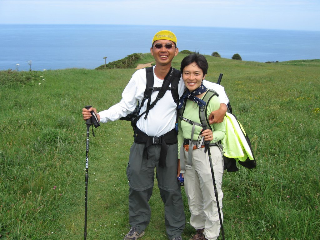
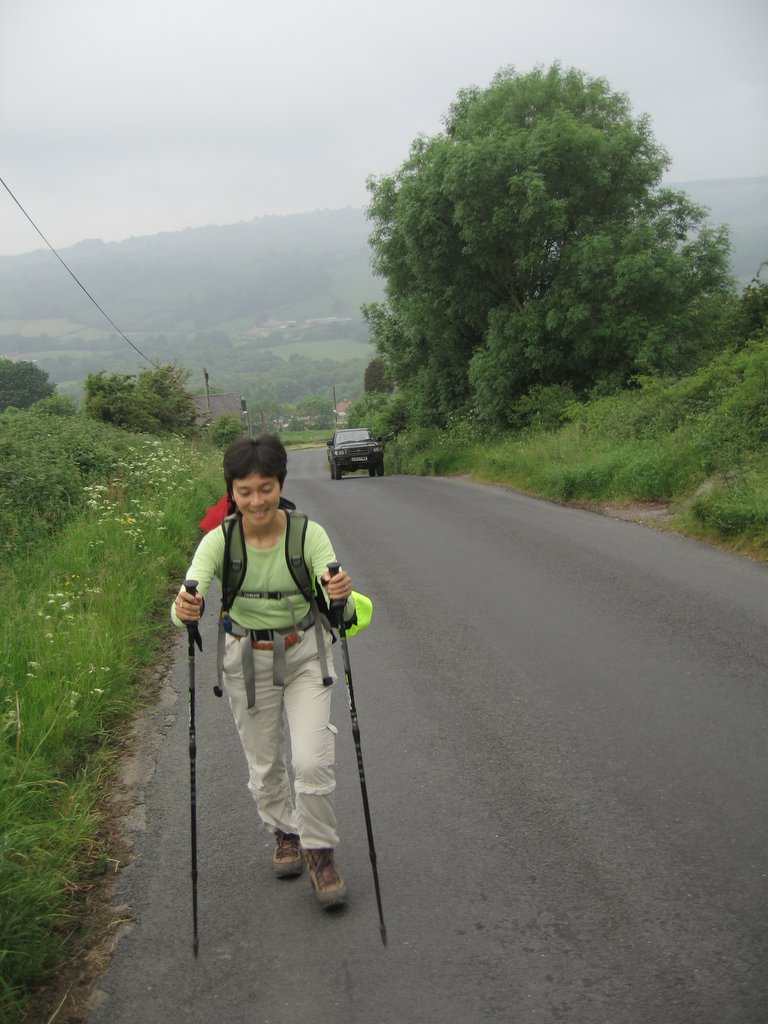
Coast to Coast Index
This is just a place holder page (a permanent location, if you will), for all the coast-to-coast related text posts. Luckily for me, Google debut Picasa Web Albums just in time for me to host the pictures from the Coast to Coast.
[Update: The trip report is now largely complete, pending revisions to some of the shorter entries]
- St. Bees to Ennerdale Bridge
- Ennerdale Bridge to Stonethwaite
- Stonethwaite to Grasmere
- Grasmere Rest Day
- Grasmere to Patterdale
- Patterdale Rest Day
- Patterdale to Shap
- Shap to Orton
- Orton to Kirkby Stephen
- Kirby Stephen to Keld
- Keld to Reeth
- Reeth to Richmond
- Richmond to Danby Wiske
- Danby Wiske to Osmotherley
- Osmotherley to Blakey Ridge
- Blakey Ridge to Egton Bridge
- Egton Bridge to Robin Hood's Bay
- Conclusion
- Equipment Recommendations
- B&B Notes
- On British National Parks
- Tips for the Trip
- Addendums to the Stedman Coast to Coast Trail Guide
- Packhorse Versus SherpaVan
- Photos
[Update: The trip report is now largely complete, pending revisions to some of the shorter entries]
I'm back!
Went for 42 miles of riding today, and it's such a relief going at 15mph instead of 3mph! And having painless descents... Unfortunately, any fitness I gained by walking didn't transfer to cycling, as I found myself slower on the bike as a result of not having been on the bike for 3 weeks. To top that off, I also felt pain in my left ankle --- looks like I injured it a bit during the walk. Hopefully, the recovery is quick!
Now to get my slide film developed and to deal with bills...
Now to get my slide film developed and to deal with bills...
Equipment Recommendations
Here's a list of equipment that worked particularly well. Not to say that the other equipment we brought didn’t work, but we were particularly grateful for those.
- Pants with zip-off legs. Very good for reducing amount of clothing we had to carry while being versatile in all sorts of weather conditions. Of the ones I owned, the Ex-Officio ones were outstanding, and I used them every time I wanted to do a very long walk, and they’ve served quite well.
- Mont-bell and Go-lite Dome Trekking Umbrellas
- DuoFold Synthetic T-shirts. At $7 a T-shirt, the long sleeves are warm when it’s cold, cool when it’s hot with wicking fabric, and quick drying. Quite a steal from Campmor.com.
- Camelbaks
- Sennheiser PX 100-II Supra-Aural Mini Headphones - Black
—these really proved themselves capable of surviving the abuse and rigors of a cross-country hike! Triply recommended.
- REI Peak Ultra-lite Trekking Poles. I hesistated on spending $100 on a pair of these (Lisa & I used one each, but they're only sold in pairs), but I shouldn't have. They do have the tendency to slip a bit under heavy use, but it's a small price to pay for the weight.
Osmotherley to Blakey Ridge
Gillian offered me breakfast at 6:00am, since I wanted an early start—another reason to select the Mill House if you’re in that area and want an early start—as far as I know, she’s the only one who will do so!
Gillian dropped me off right at the foot of the path to the Swainstye farm, which she told me would take me to the booster station at the top of the hill. I’m glad she knew where to take me, because I was expecting a dirt road, but it was instead very nice pavement. The walk up was quick in the cool morning air, but the cloudy sky was definitely a hint that this was not going to be another, hot dry day.
At the Booster station, I picked up the Cleveland way, marked with the sign of an acorn. I walked along the forest, and then out into a moor. A light drizzle started to come down right after I put on sunscreen in a fit of optimism, but the trail immediately dived into a forest trail, so I did not bother putting up the umbrella since the forest canopy was thick enough to prevent any rain from actually touching me. I put on my ipod and plugged away.
The trail went up and down, but I made good time and soon hit Lord Stone Manor at 10:00am, much earlier than anticipated, and had not used much of my water. I took the opportunity to fill up, since this was the last chance to fill up for the rest of the walk. There., I met Ray, and offered to walk together with him, but he demurred, saying that he couldn’t keep up with me with that my lightweight setup today.
I went on ahead then, pushing my way up the hills. It was warmer now, but with the wind blowing at a pretty good clip. I started to feel driven by twin demons of rain and wind. Add sun to it and I felt compelled to move as quickly as possible, eating and drinking on the move, stopping only to change socks or take something out of the pack.
Soon enough, I hit the Wainstones past Clay Bank top, the last climb of the day. I saw no obvious way up Wainstones, and ended up following a path around it which resulted in some scrambling, but reached the top with no ado. Then the long walk on Urra Moor. The book said it would take 45 minutes, but at about an hour, I still hadn’t seen any of the landmarks described in the book. Getting worried, the trail narrowed and I approached something of an obstacle across the path.
Fortunately, there was a couple sitting on an embankment having lunch, so I asked where I was. The man hopped up and told me that I wanted the railroad track, which I was at (the Rosedale Junction), not any of the turn-offs that was prominent there. This turned out to be a fortituous stop, since everyone behind me would take an incorrect turn at this point. And no wonder, since when I asked him to point out where I was on the map, I was a full page away from where I thought I was!
I walked along the boring path, stopping to change socks at this point, and ate three bars in rapid succession. I then ran into a guy with a Land Rover who agreed to take a picture for me. I then met some walkers who were doing the coast to coast East to West, and they told me I was two hours away from the Lion Inn. Indeed, at 2:30 I spotted the Lion Inn. The sky started to cloud over and rain drops started falling, prompting me to open my umbrella. I strolled along, not too worried and pretty comfortable under my umbrella, but then the wind grew strong and the raindrops grew heavier. I quickened my pace, and soon reached the bottom of the turn-off to Blakey Ridge, which was unsigned.
Lightning and Thunder were now evident around me, and I stared at the Blakey Moor sign for a half second before deciding that if there was any time to run now was it. I leapt up along the trial, trying to dodge the puddles that had just formed, but in vain—the water was now coming down in sheets. The umbrella was holding up, but with the deluge of water I was getting soaked anyway! By the time I got to the Inn, I was quite a sight, and made an impressive entrance into the Inn—umbrella dripping in my left hand, hiking stick in my right, also dripping, clothes drenched from hat to shoes. If I had thought about it, I would have struck a pose like Sarah Michelle Gellar at the end of the Buffy episode, since all that liquid dripping off my stuff would have evoked that image, “Anne.” Lisa was there at the Inn having tea right at the entrance and was relieved to see me, drenched as I was.
Friday, June 16, 2006
Group Photo at the Bay Hotel
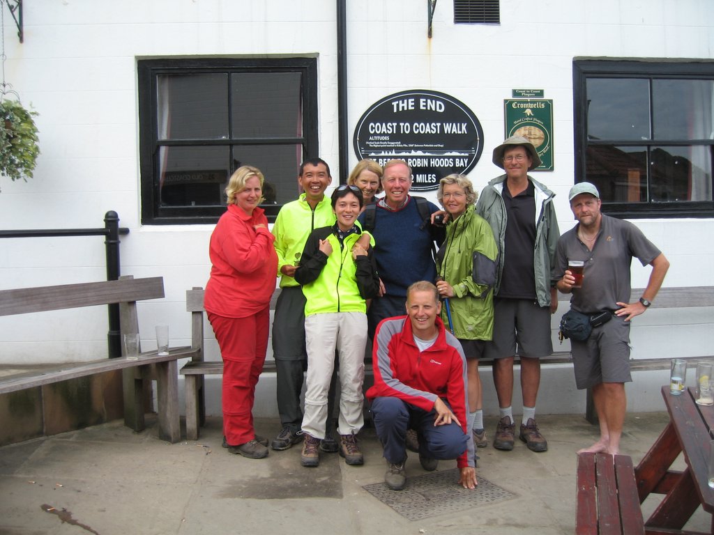 Yannika, Piaw, Lisa, Margaret, Peter, Eric (squatting), Bey, Andy, and Ray.

Thursday, June 15, 2006


Along the dismantled Iron Ore Track
 At 17 miles out of 21 miles to go, in the Yorkshire Moors along the Rosedale Ironore dismantled railway.
Subscribe to:
Comments (Atom)


